14 — Linville Gorge, April 2-5, 2015.
2015-04-05. By Kelly.
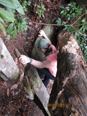
Fig. 1. All pictures here are from the area where the Spencer Trail meets the Linville River. Here Kelly is descending down a hole in our scramble along the river edge.
This week Patrick and I ran away for a long weekend to Linville Gorge. The weather reports were calling for rain but we didn't care. We were excited to be out and hiking on trails. Our goal was to cross Linville River and hike the Linville Gorge Trail to see the Prow. The Prow is a climbing area that Patrick and I are interested in climbing in the future. Our first day was spent on the Spence Ridge Trail with no rain and warm weather. Spencer Trail is a beautiful little trail that leads down to Linville River. Along our route we visited three different campsites. The first site had great benches surrounding a large fire pit and could host four tents easily. The other sites were along the stream leading to the Linville River and sported great views of the stream as well as the relaxing sound of running water. At the Linville River, we noticed that the river spans about 15-40 meter across along the areas that we hiked. We also discovered that the bridge was out and we were unable to cross. It was difficult to be disappointed by the bridge being out since the view along the river was incredible. On a flat large rock in the center of Linville River, we had lunch on stairs that was once connected to the bridge. We enjoyed the view and the sounds of the river flowing around us. After lunch, we then spent over an hour scrambling over rocks to find a crossing. After we gave up crossing the river, we continued going along the river to get some great camera shots. One great view would lead us to another and before we knew it an hour had gone by. On our way back, we decided to go the Table Rock Trail route. Table Rock Trail is another hiking trail leading off the Spencer Ridge trail. This trail also had a number of camp sites spread out along the route. On the table Rock trail you felt nestled within an older forest. As you entered into the older stand of the forest you noticed very little undergrowth which afforded great views of the terrain. As I was hiking along this trail with Patrick, I checked the time and started to calculate the time it would take us to return. I realized that I wanted to still have legs left for tomorrow and convinced Patrick to turn around at the base of Table Rock Mountain. Patrick is a very good sport about quick changes to our game plan and went along with my idea to return to the car. Overall, we covered approximately 7.4 km during our six hour not including scrambling along the river.
The next day, we had the same goal of hiking down to the Linville River to get a better view of a future climbing project and finding the bridge to cross. This time we decided to use the Pinch In Trail to get to Linville River from a different direction. Another beautiful day that started out at a cool 10 degrees and warmed up to a sunny 16 degrees Celsius. The Pinch In Trail was steeper than the Spencer Trail and followed a ridge down to the river. It afforded wonderful views of the canyon. We were able to see the Prow from several different directions and identify it clearly using pictures we had gotten from the internet as well as a National Geographic topo map. Patrick also took way points on our GPS, and compass readings to help better identify the rock face clearly. The Pinch In Trail would be quite difficult with a full pack and worth it. The camping sites are beautiful along the river and some can host four tents easily. At 11:30, we stopped for lunch along Linville River at the base of Chimney Gap. During lunch we enjoyed Isaac's freeze dried astronaut ice-cream sandwich. It was awesome and we will be asking for more in the future. Linville River flows about 30-60 meters across in the kilometer area we hiked up the trail. It also has incredible assortments of rocks to scramble over and lunch on. We didn't cross the river. However, if we had warmer water temperatures and more time, we would have crossed. When we decided to head back, I was concerned about our return hike since it took an hour and half of downhill hiking to get to Linville River. I expected that it would take us at least two to three hours to get back. Instead, our return took an hour and forty five minutes. We covered 8.1 km during our six hour hike. There was a net elevation change of 520 m from trail head to river. We came back with great pictures and a new place to run away to on long weekends. These day hikes along the Linville River have renewed our interest in camping, climbing, and hiking. On our drive back home, we planned a hiking and climbing trip for next weekend.
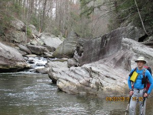
Fig. 2. Looking up river, Patrick at right, behind him is the direction we went to do most of the scrambling.
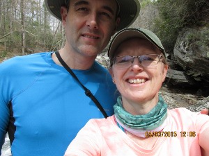
Fig. 3. Happy times.
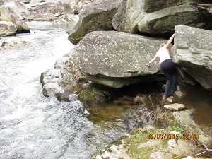
Fig. 4. Kelly the Boulder Master.